




 3:37 AM

Paper presented at the Arakanese History and Religion Seminar, London, August 2009
By U Khin Maung Saw
8/9/2009
1. Introduction:
Among the 7 Union States of Burma the Rakhine State or the Arakan is the immediate neighbour of the Subcontinent. There might have been some contacts between Arakan and the Subcontinent since the first dynasty of the Arakanese. Buddhism and the Pali language used in Buddhist Canons came very early to the Mons, Arakan and Pyus, much earlier than the emigration of the Burmese in the country which is now Burma. Pyu, Mon and Burmese/Arakanese scripts were based on the South Indian scripts.
The Rakhaings (Arakanese) traditionally believe that they are the descendants of the “Sakya Sakis” the race from which Lord Gautama Buddha came[1]. Most historians and anthropologists, however, say that they belong to the Tibeto-Burmese groups.
The Arakanese (Rakhaing/Rakhine) believe that their ancestors had to chase out the demon-like beings (most probably Negrito tribes) before they established their first kingdom. After that the people had to be very united to repel the invasions of the tribes they chased out. That’s why they named themselves Rakkhita People. The Pali word Rakkhita means ‘the one who protects his own race’. And therefore their country was called ‘Rakkhita Mandala’ and later deviated to ‘Rakkhita Mandaing’ and then to ‘Rakkha Mandaing’. The word “Arakan” is therefore a derivation of “Rakkha Mandaing – Rakhaing” – “Arakhaing” – “Arakan”.
There is another hypothesis: The Sanskrit word rakshasa, Pali rakkhaso can be translated as “the demon of water” or “an ogre-like being living in water”. That’s why the etymology of Arakan can be traced as a Sanskrit or Pali words A-Rakkha Desa (The Land which is now free from the Demons). The word “Arakan” is therefore a derivation of “A-Rakkha Desa – A-Rakkhan” – “Arakan”. Sir Arthur Phayre as well as Col. Henry Yule and A. C. Burnell’s “Hobson-Jobson” A Glossary of Colloquial Anglo Indian Words and Phrases, and of Kindred Terms, Etymological, Historical, Geographical and Discursive (First Published in 1886) supported this version too[2].
2. Religions in Arakan:
2.1. Hinduism:
There is no doubt that the early kingdoms of Arakan were Hindu states. Some Hindu deities were found in ancient cities. However, Hinduism might have been replaced by Buddhism when the kings and people became Buddhists.
2.2. Buddhism:
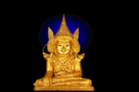
According to the legend of the Maha Muni Image, Arakan was already a Buddhist Kingdom during the time of Lord Buddha because Lord Buddha visited Arakan due to the invitation of King Sanda Thuriya (Chandra Suriya).
U San Shwe Bu[3], on the other hand, wrote that King Sanda Thuriya ascended the throne of Arakan in 146 A.D, six hundred years after the Pari Nibanna of Lord Buddha.
Contrast to the legend he stated that the statue was casted in the 2nd century AD.
In any case, it is safe to say that Arakan became a Buddhist Land at the beginning of Anno Domini, if not earlier. Since that time Arakan remains a Buddhist land till now and all Arakanese or Rakhaings are devout Buddhists. Nowadays, population ratio between Arakanese and Burmese may be 1:10, however if one compares the number of Buddhist temples, monasteries, monks and nuns the ratio is only 1:4. It is proven how religious Arakanese or Rakhaings were and are.
Arakan was well known to be “the Land of Pagodas and Temples”. There is a famous Arakanese verse: Thazun pan Khaing ta mraing mraing Rakhaing Phara paung”, which was nicely translated into English verse by U Tha Hla as: “The Thazun (a type of orchid) sprigs in sheer clusters, Sum the total of the pharas grandeur”. According to this verse, there were 6352755 Pharas (Buddha Statues) in Arakan.
Maurice Collis described the situation of Buddhism in the year 1630 during the reign of Min Hayi (Man Hari) alias Thiri Thudhamma (Sri Sudhamma). In his book The Land of the Great Image, in page 168 where it was written: “The Buddha had died in 543 B.C. Altogether 2173 years had elapsed since then, and for that immense period the image of the Founder of the Religion had remained on Sirigutta, the oldest, most mysterious, the most holy object in the world. The relics detailed to the disciples on Selagiri had all been found and enshrined. Arakan was a sacred country; it was the heart of Buddhism; and he (King Thiri Thudhamma) as its king, was the most notable Buddhist ruler in existence. Grave indeed was his responsibility. He had not only to maintain the state as the homeland of the Arakanese race, but as the one place on earth where an authentic shape of the Tathagata was preserved, a possession of greater potency than the most precious relics”.
Buddhists kings with Pseudonym Muslim Titles:
All kings of the Mrauk U dynasty, the last dynasty in Arakan, were Buddhists. Some kings had assumed Muslim Titles because, Min Saw Mun (Man Saw Muan), the founder of the Mrauk U City wanted to show his gratitude to the Sultan of Gaur who helped him regain the Arakanese throne in 1430. Hence, he promised the Sultan that the Arakanese kings would bear Pseudonym Muslim Titles. But in fact, all of the Arakanese kings were donors of many temples in Mrauk U as well as in the other parts of Arakan. They did make coins, one side with Burmese/Arakanese scripts and the other side with Persian (NOT Bengali).
For example: Min Saw Mun (Man Saw Muan), the founder of the Mrauk U City with the assumed Muslim Title ‘Suleiman Shah’ built seven Buddhists temples in Mrauk U. One of them was Laymyetna Phaya (Leemyatna Phara) in Mrauk U (now Mrohaung). His successor and younger brother Min Khayi (Man Khari), who had an assumed Muslim Title ‘Ali Khan’, erected the Nyidaw Zedi (Satee), which can be roughly translated as ‘The Pagoda built by the Younger Brother’. His son and successor King Ba Saw Phru alias Kaliman Shah constructed four Buddhists temples including the Maha Bodi Shwegu Pagoda. His son Dan Ugga alias Daluya, who bore the Muslim Title Moguh Shah, was the donor of Thongyaik Tasu Temple (meaning the temple of Thirty One Buddhas). His successor Min Yan Aung (Man Ran Aung) alias Narui Shah founded the Htupayon Pagoda. Min Bin (Man Ban) had an assumed Muslim Title of Zabauk Shah; was the donor of seven temples including Shit Thaung Phaya (Shite Thaung Phara) or the Temple of Eighty Thousand Buddha Statues. Min Phalaung (Man Phalaung) alias Secudah Shah was the donor of six temples including Htukkan Thein, his son Min Yaza Gyi (Man Raza Gri) with the Muslim Title Salem Shah donated Phaya Paw (Phara Paw) Pagoda and Pakhan Thein in Mrauk U and also Shwe Kyaung Pyin Monastery in Thandwe. Min Khamaung, who subjoined the Muslim Title Hussein Shah constructed Yatanapon (Ratanabon) and Yatana Pyethet (Ratana Prethat) Pagodas and his son Thri Thudhamma (meaning the Protector of Buddhist Religion) alias Salem Shah the Second, erected the Sekkya Manaung (Sakkya Manaung) Pagoda.
The Burmese invasion in 1784, led by the Burmese Crown Prince then, was to snatch the Holy Maha Muni Image, the national Symbol of Arakan. Nowadays this colossal image can be seen near Mandalay and the statue is called in colloquial Burmese Phayagyi (Paragri), which is the direct translation of Pali Word Maha Muni. During the British Era this temple was translated as ‘Arakan Pagoda’.
2.3. Christianity:
Many Portuguese mercenaries served under Arakanese kings since 16th Century A.D[4]. Later, the Dutch mercenaries did the same job. So, there is no doubt that there must have been some Christians in Arakan, but almost all of them were foreigners with very few Arakanese who converted into Christianity through marriage.
According to Maurice Collis and U San Shwe Bu[5], in 1610 Arakanese King Razagri had appointed his younger son, Min Mangri, Viceroy of Chittagong. This prince was not in good terms with his elder brother and the crown prince then Min Khamaung, the Viceroy of Thandwe. Min Khamaung was a rebellious Prince towards his father, hence the king wanted to replace the position of the crown prince from his elder son to the younger son. However, Min Mangri made friendship with the Portuguese pirate-king Gonsalves Tibau of Sandwip Island. The marriage of Min Mangri’s daughter with Tibau’s son was agreed and she had to convert into Catholicism. Min Mangri had three children, two daughters and a son. In the year 1610 his son was four years old.
When King Razagri heard of this marriage and realized that this younger son was now allied with the ruffian who had treacherously seized his fleet, in 1612 Razagri sent an army under the Crown Prince Min Khamaung. Min Khamaung took this duty willingly, because his own right to become the future king was threatened. In the battle Min Mangri was shot dead and finally Gonsalves Tibau surrendered. The King of Arakan, decided to pardon Gonsalves Tibau and invited him to contrive some way of saving the young prince and his sister, who were his own grand children.
Meanwhile Min Khamaung had entered Chittagong without opposition and after attending his brother’s funeral immediately called for his nephew and niece. When they were not forthcoming, he suspected Tibau, but it was not until afterwards that he learnt they had escaped to the Moghul Empire. Foiled in this, he finished his business and returned to Mrauk-U, where later in the year he succeeded his father when his father died.
Later these two children of Min Mangri were baptized by the Catholic priests. This son of Min Mangri afterwards became known as Dom Martin, a Catholic and the first Arakanese who went to Europe.
2.3.1 The term ‘Phalaung’:
Phalaung is the Arakanese term for the Portuguese. It is a corrupted word from Persian Farangi or Firingi, i.e. a Frank, meaning European. This term for European is very old in Asia. Till now, in Thailand all Whites are called “Phalang”. The Burmese used to call Portuguese as Ba-yin-gi (Barangi), a corruption of Farangi. However, a modern Burmese meaning of Ba-yin-gi is for Roman Catholic Christians.
This Arakanese king, Min Phalaung’s real name was Chit Hnaung (Shite Hnaung) meaning the latest beloved (son). He was the youngest son of Min Bargyi (Man Bargri) and was born on that day when Arakanese armed forces destroyed the Portuguese fleet and conquered the Portuguese Fort of Dianga. That’s why his father named him Min Phalaung (Man Phalaung) which can be roughly translated as “King or Ruler of the Portuguese”.
Here, I would like to cite Maurice Collis, “The appeal of the Portuguese”: “We (the Portuguese) have come to assure His Majesty that the Portuguese of Dianga are His Majesty’s devoted humble servants, as they have ever been in the past, having served him and his father and grandfather of the glorious memory, not only by harrying the Mogul in Bengal, but fighting his enemy, the king of Pegu. If God grants me the fortune of being admitted to the royal presence, my endeavour will be to convince His Majesty of my nation’s continued desire to serve him”.[6].
The first chapel, however, was built only after 1630 A.D., because the Catholic Missionary of Augustinian Order, Father Sebastien Manrique arrived Arakan from Goa in 1630 and asked permission to build a chapel from the Arakanese king. King Thri Thudhamma was so kind by not only allowing the Portuguese priest to build a chapel near the royal palace, but also he lent him money. In the opening ceremony of the church the Arakanese king lent him golden flower vases decorated with various jewels. Father Manrique recorded this in his memoirs by praising King Thri Thudhamma that the Buddhist king was so generous and helped him what even monarchs of other Christian sects would not have done although they share the same god and follow the principles of Jesus Christ.[7].
Father Manrique also recorded that though Arakan had a common border with India, particularly with Bengal, there was nothing common between Arakanese and Bengalis or Indians regarding race, features, language, religion, characters, mentality, culture, traditions and civilization. He also recorded that he had never seen a single Arakanese (Rakhaing) who became a Muslim.
Here, I would like to cite some words of Father Manrique: “The city of Arracan according to general opinion must have contained one hundred and sixty thousand inhabitants, excluding foreign merchants. There were also a great number of foreign merchants, as there were many ships trading with this port from Bangala, Masulipatan, Tenasserim, Martaban, Achen und Jacatra. There were other foreigners also, some being merchants and some soldiers, the latter being enlisted on salaries; these soldiers were Portuguese, Pegus (i.e. Mons) Burmese and
Mogors (Moguhls) in nationality. Besides these, there were many Christians of Japanese, Bengali and other nationalities”.[8]
4. Islam
1.Muslim Settlements in Arakan:
1.Pre Colonial Era:
Arakan has a common border with Bengal, so there is no doubt that there must have been some Muslim settlers in Arakan even before the Mrauk U Dynasty was established, however, their number could be negligible and apart from that they were not Arakanese (Rakhaings) instead they were some foreigners.[9]
Some Muslims claimed that Muslim settlements in Arakan date back to the 9th century A.D”. This statement is wrong and baseless, because even in Bengal the Muslim settlements began much later, and in Chittagong not until the 14th century. In the ninth century A.D., even the biggest country in Southeast Asia with the world’s largest Muslim population, Indonesia, was under the Sri Vijaya Empire, which was a Hindu-Buddhist Empire.
Maurice Collis wrote very clearly: “Bengal was absorbed into this polity, [that is, Islam] in 1203 A.D. But it was its extreme eastern limit. It never passed into Indo-China; and its influence from its arrival in 1203 till 1430 was negligible upon Arakan”[10].
2.4.1.2. Kaman Muslims:
The real Muslim settlement began only after Min Saw Mun (Man Saw Muan) regained the throne of Arakan with the help of the Sultan of Gaur. There were some Muslim troops in Mrauk U to protect Min Saw Mun (Man Saw Muan) from the Burmese invasion. About two hundred years later, some followers of Mogul Prince Shah Shuja joined the descendants of these soldiers. These groups of mercenaries were Afghans and Moguls. They were called “Kamans”, meaning archers in Persian language. Their descendants still live in the Rakhine State, particularly in Akyab (Sittwe) District and Rambree Island. Now they are assimilated into the Arakanese society. Only in religion and complexion do they differ from the Arakanese (Rakhaing), they know the Arakanese language, literature and Buddhist traditions very well. Most of them have Burmese/Arakanese names. They rarely used their Muslim names.
2.4.1.3. Myay Du Muslims:
There are some Muslims living in Thandwe District. These Muslims are called “Myay Du”. They are the descendants of the former “Pagoda Slaves”.[11] When King Min Bin (Man Ban) alias Min Bargyi (Man Bargri) reoccupied the Chittagong District in A.D. 1533, he brought back some Bengalis as prisoners of war and let them work as menial workers at Andaw, Nandaw and Sandaw Pagodas in Thandwe. Since they had to do menial works and were not free people anymore, they were called “Pagoda Slaves”. In the year 1624, these Bengali “Pagoda Slaves” supported the ‘Palace revolution’ of the ‘Viceroy of Thandwe’ against his own father, the Arakanese king. After the aborted revolution against the Arakanese king these ‘Bengali Pagoda Slaves’ and their families, all together about four thousand people, escaped to Ava to take refuge. The Burmese king accepted them as his subjects, gave them their freedom by royal orders declaring that they were no longer “Pagoda Slaves”, and let them settle in the small town Myay Du. That’s why they were known as “Myay Du Muslims”. These “Myay Du Muslims”, generation by generation, served in the Burmese Royal Army. When Bodaw U Waing’s armies invaded Arakan in1784, the descendants of these “Myay Du Muslims” came together with the Burmese Army at Thandwe front. When the Burmese occupied Arakan they let the “Myay Dus” resettle in Thandwe and nearby villages. Since these people had lived about 150 years in Upper Burma, these “Myay Dus” were assimilated into Burmese society. Although their descendants live in Thandwe District, they speak Burmese central dialect instead of Arakanese Thandwe Dialect. Only in complexion and name (in some cases only) do they differ from the Arakanese and Burmese, yet they know the Burmese language, culture and traditions very well. Officially, they have Burmese/Arakanese names. They rarely use their Muslim names in public.
Since the “Kamans”, the descendants of Afghan archers started living in Arakan since 1430 and their population increased in 1660 when Sha Shuja followers joined them, and the “Myay Dus” the descendants of Bengali “Pagoda Slaves” started living in Arakan since 1533 they may be called “the Indigenous Muslims of Arakan”. For centuries to now, these “Indigenous Muslims of Arakan” lived and live peacefully with Burmese and Arakanese (Rakhaings), who are Buddhists. Even in the country-wide racial riots between Buddhists and Muslims starting from Rangoon in 1938, there was not a single riot in Thandwe[12].
2.4.1.4. The Colonial Era:
2.4.1.4.1 Early Bengali Muslim Settlers:
Only after the British annexed Burma and placed under the umbrella of the British Indian Empire did a lot of Bengalis, especially from Chittagong, came to settle in Arakan, particularly in the north. After the First Anglo-Burmese War which broke out in 1824 and ended in 1826, some parts of Burma were annexed by the British. These areas became part of British India since 1826. Hence, since 1826 people from the Subcontinent were able to come to Burma freely, unconditionally and some were brought by the British for various reasons. However, the volume of Indian immigration before the middle of the nineteenth century, though continuous, was never on a very large scale compared to what it came to be from 1852 onwards. A new chapter in the history of Indian immigration into Burma began after the British annexation of Lower Burma after the Second Anglo-Burmese War (1852), and the whole of Burma after the Third War in 1886. The opening of the Suez Canal in 1869 marked a turning point in the economic and administrative history of British-Burma. The British government wanted to export Burmese rice and they extended the rice fields in Arakan, Tenassarim and Lower Burma, and they also wanted to construct railway lines. As they needed peasants and coolies they imported tens of thousands of Indians.
There were five types of Indian immigrants: (1) Permanent settlers; (2) Long-term settlers, who came to seek their fortune in the then most prosperous country in Southeast Asia, but for retired life they preferred to stay in India rather than in Burma; (3) Seasonal workers who came for a fixed short period; (4) Government servants and traders who wanted to earn and save money so that they and their offspring could settle permanently in Burma as rich people; and (5) People brought by the British for various reasons.
Because of that the famous archaeologist in Burma Prof. E. Forschhammer had predicted that generally Burma, particularly Arakan would become the ‘Palestine of the Far East’[13]
2.4.1.4.2. Bengali Settlers during the Colonial Era:
Arakan has very fertile soil with sufficient rain falls, hence, British wanted to expand rice fields in Arakan. Since the country was under-populated and has a direct land border with Bengal, particularly with Chittagong District, many Chittagonian Bengalis were brought to Arakan as cheap labourers, peasants and coolies.
Some Chittagonian Bengalis were brought to Arakan to construct a railway track between the two towns, Butheedaung and Maungdaw. The construction project (1916-18) stopped without finishing the railway line, but those Chittagonian Bengalis never returned back to Bengal.
These latter Bengali settlers are called “Khawtaw Kalas” in both Burmese and Arakanese.
Some settlers learnt Arakanese and Burmese; hence, some of them were assimilated into the native society. However, these Chittagonian Bengalis differ from the Arakanese in their features, complexion and religion as well as in some customs which their religion directs; in writing they use Burmese but among themselves employ colloquially the language of their ancestors, either Urdu or Bengali. They never named themselves ‘Rohingyas’ but ‘Arakan Muslims’. Since they were assimilated in the native society, Burmese as well as Arakanese (Rakhaings) did not call them Khawtaw Kala any more, but used the term Muslims, just to differentiate them from the natives who are Buddhists. Though Kamans and Myaydus are Muslims they were already assimilated in the native society. When one hears the name Kaman or Myaydu, one knows automatically that they are Muslims.
Unfortunately, however, many latter settlers never tried to assimilate into the native society and therefore they were and are never welcomed by the natives, neither by the Burmese nor by the Arakanese society. Nor could they join even in the society of “Indigenous Muslims of Arakan”, the “Kamans” and the “Myay Dus”. That was the main reason why racial riots happened often during the whole colonial era and also in post-colonial era, especially in Northern Arakan.
After Burmese Independence:
3.1. Bengali Settlers’ Plan to split Arakan:
After Burma regained her independence Bengali settlers wanted to turn northern Arakan into an autonomous Muslim state. “Some members of the ‘Juniyatu Olamai’ religious association went to Karachi on a delegation to discuss the incorporation of Butheedaung, Maungdaw and also Rathedaung townships into East Pakistan”[14]. The Arakanese (Rakhaings) could not tolerate it, and there was bloodshed because of riots between the Arakanese and the Bengali settlers. Eventually some of these settlers went back to East Pakistan but some of them went underground and called themselves “Mujahid” rebels fighting U Nu’s government while the rest of them remained in their villages. With the help of educated Bengalis from Arakan and Rangoon they demanded for Burmese citizenship.
3.2. Mujahid Rebels:
The leader of the “Mujahids rebels was Mir Cassim, an uneducated fisherman. It was only an illusion of an uneducated man like Cassim who wanted to turn a traditionally Buddhist land like Arakan, which is full of temples, monasteries, monks and nuns, into a Muslim state. As a result, in the 1950′s these rebels were totally crushed. Some surrendered while some fled to East Pakistan. Cassim fled to East Pakistan and he was shot dead in Cox Bazaar by an unknown person in 1966.
Both surrendered Mujahid and Bengali Muslim Settlers did not want to be called Khawtaw Kala or Kala which according to their own interpretation supposed to be derogatory because ‘Kala’ means ‘dark’ or ‘Coloured’ or ‘Blackie’ in the languages such as Hindi, Urdu, Bengali . In fact, the literal pronunciation of the Burmese as well as Arakanese word ‘Kala’ is ‘Kula’ and also written as ‘Kula’. This term was derived from the Pali or Sanskrit word ‘Kula Puttra’ meaning ‘the son of a noble race’ because Lord Buddha himself was an Indian. Both Po and Sagaw Karen word for Indian is ‘Kula’ and the Thai word for Indian is ’Kal’. Hence, it is not derogatory instead it is ‘a word of courtesy’!
Anyway, Bengali Muslim Settlers did not want to be called ‘Kala’. As a result, they settled for the name “Rohingya”. In the late 1950″s, the demand for the statehood of the Rakhaings (Arakanese) and the Mons was at the peak. The Bengalis who started calling themselves “Rohingyas” asked for the same status as the Arakanese (Rakhaings). When their demands were turned down by the Burmese government on the grounds that they were not an indigenous race of Arakan, some educated Bengali Muslims like M. A. Tahir, well known through his Burmese name Ba Tha, Maung Than Lwin and some Bengali Muslim students from the University of Rangoon began to fabricate historical facts to prove that they were “Indigenous Arakanese Muslims” and started to fabricate stories that they and their ancestors belonged to Arakan historically.
Evolution of the word ‘Rohingya’:
3.3.1. The possible etymology of the term ‘Rohingya’:
There are many stories fabricated by educated Bengali Muslims to prove that their ancestors were the indigenous ethnic minorities of Arakan but all of them are baseless. However, the possible etymology of the term ‘Rohingya can be traced as follows:
3.3.2. Corruption of Arakanese word ‘Rahauntha’:
After the Second World War when British Administration restarted in Burma, all Bengalis who went back to Bengal during the war came back to Arakan. They brought many new settlers with them. Because of their immigration waves many Arakanese left their villages in Northern Arakan and moved southwards. These villages were named “Old or Deserted or abandoned Villages”, Ywa-Haun in Burmese (Rwa-Haun or Ra-haun in Arakanese pronunciation). The villagers of Ywa-Haun were called Ywa-Haun-Tha in Burmese (Ra-Haun-Tha in Arakanese pronunciation). Those Bengali new settlers could not pronounce ‘Ra-Haun’ as well as Ra-Haun-Tha properly and called with their Bengali accent “Ro-han” and the “Ro-han-za”, respectively. Later it deviated to ‘Ro-han-ja’ and then ‘Ro-hin-gya’.
3.3.3. The statement of Arakanese (Rakhaings) in Bangladesh or Anauktha
According to them, in the Bengali Chittagonian dialect the term ‘Rohingya’ referred to the people of inland Rakhaing Buddhists. These Rakhaings of the West stated clearly that it is a name used by the Bengalis to denote a Rakhine – a Buddhist Rakhine. Since the word is of Bengali origin, some of the Muslim secessionist groups used the name to identify themselves to be the natives of Arakan and named themselves as ‘Rohingya’.
3.3.4 The name ‘Rohingya’ in Arakanese History:
5.British contributions about Muslims in Burma:
I searched for the ethnic group ‘Rohingyas’ in all history books, literature, encyclopaedias and other publications published before 1953 written by foreign scholars. Unfortunately, I did not find any. None of the British Colonial Officers recorded the name ‘Rohingya, neither in the Indian Subcontinent nor in Burma. To be honest, I had never heard of the word “Rohingya” until the late 1950′s.
1. “The fact that there has never been a “Rohingya” ethnic group in Burma is quite evident. There is no such name as “Rohingya” in the Census of India, 1921 (Burma) compiled by G. G. Grantham, I.C.S., Superintendent of Census Operations Burma, or in the Burma Gazetteer, Akyab District (1924) compiled by R. B. Smart.
2. Even in Hobson-Jobson. “A Glossary of Colloquial Anglo Indian Words and Phrases, and of Kindred Terms, Etymological, Historical, Geographical and Discursive” published by British Colonial Officers of British East India Company, Col. Henry Yule and A. C. Burnell (First Published 1886) the word “Rohingya” was not mentioned. Since this book was published by the Bengal Chamber Edition, Calcutta, India, and is an indispensable dictionary for those who want to study the history of India during the last 300 years and its impact on the East and West, it should be considered as a standard literature.
3. The well known author and scholar, Maurice Collis, who wrote many articles and books about Arakan, also never mentioned the word “Rohingya”.
4. None of the British Colonial Officers’ contributions about Burma and India mentioned that word “Rohingya”, however, they mentioned about ‘Zerabadi’ the Indo-Burmese Hybrids or “Burmese Muslims”, the Muslims in Shwebo and Yamethin Districts in Burma Proper, “Myay Du Muslims”, “Kaman Muslims” and Bengali Muslim Settlers of Arakan.
5. In the book „The History of Modern Burma, by J. F. Cady, 1965, he neither mentioned the name ‘Rohingyas‘ nor the Arakanese Muslims.
6. Indeed, Francis Buchanan[15], a Scottish Doctor working with British East India Company, who accompanied the British envoys to the Court of Ava, the Capital of the then Burmese Empire, was one and the only person mentioned in an Article the names ‘Rooingas’ and ‘Rossawns’, the closest name to ‘Rohingya’ as a linguistic survey through the Provinces of Chittagong and Tiperah, however, he described those people as both Hindus and Muslims and their languages as dialects of Bengali. In any case, he wrote very clearly that they are called Kala or Strangers or Foreigners by the real natives of Arakan, i.e. Arakanese or Rakhaings (Francis Buchanan 1801).
I would like to cite his writing:
‘I shall now add three dialects, spoken in the Burma Empire, but evidently derived from the language of the Hindu nation. The first is that spoken by the Mohammedans, who have long settled in Arakan, and who call themselves Rooinga , or natives of Arakan. The second dialect is that spoken by the Hindus of Arakan. I procured it from a Brahmen and his attendants, who had been brought to Amarapura by the king’s eldest son, on his return from the conquest of Arakan. They call themselves Rossawn, and, for what reason I do not know, wanted to persuade me that theirs was the common language of Arakan. Both these tribes, by the real natives of Arakan, are called Kulaw Yakain, or stranger Arakan.
The last dialect of the Hindustanee which I shall mention, is that of a people called, by the Burmas, Aykobat, many of them are slaves at Amarapura. By one of them I was informed, that they had called themselves Banga ; that formerly they had kings of their own ; but that, in his father’s time, their kingdom had been overturned by the king of Munnypura, who carried away a great part of the inhabitants to his residence. When that was taken last by the Burmas, which was about fifteen years ago, this man was one of the many captives who were brought to Ava.
He said also, that Banga was seven days’ journey south-west from Munnypura: it must, therefore, be on the frontiers of Bengal, and may, perhaps, be the country called in our maps Cashar.’
For that version I like to give the following explanation:
Since Alaungphaya (Alaungphara) reestablished the Burmese empire, he and his successors invaded and annexed almost all neighbouring kingdoms including Siam, Langxiam, Assam, Manipur, Mon and Rakhaing etc.etc.
In Arakanese chronicles and literature like (Dhanyawadi Ayaydawpon) and (Maha Pyinyagyaw Hlyaukhton) it was written that there was a Muslim Sultanate or emirate called Roang Muslim Land (Roang/Roong Pree) which was feudatory to the king of Arakan.
It is very possible that the dukedom or emirate in Bangala (Bengal) called Roang/Roong was annexed into Manipur and some Bengalis from Roang/Roong were taken as slaves to Manipur. When Manipur became a feudatory state of the Burmese empire these slaves were either given as tribute to the Ava Empire or taken by the Burmese as slaves. However, I cannot trace any single Burmese word which can be close to ‘Aykobat’ mentioned by Buchanan! In Colloquial Burmese, there is a word called ‘Khaing-bat’ or rarely ‘A-khaing-bat’ which can be translated literally as ‘he/she who has to serve all people’, so a servant!
In any case, there was and is no connection between those ‘Rooingas’ mentioned by Buchanan and the ‘Rohingyas’ nowadays, otherwise, British Administrators in Bengal and Arakan had mentioned about them. The British records clearly mentioned about Bengali Hindus and Bengali Muslims in the Indian State of Bengal. That’s why West Bengal (Hindu majority) belonged to India and East Bengal (Muslim majority) went to Pakistan when British India was divided into two Dominions, namely India and Pakistan in 1947.
Bengali Settlers in Arakan were recorded as Mohamedans and Hindus by the British.
Conclusion:
I have presented this essay in the spirit of “cetana” meaning “good will or good intention” for the sake of some people who want to know the real history of Arakan and her people.
I want to emphasize that all Muslims in Burma are not called ‘Rohingyas’, not even all Muslims in Arakan were and are called ‘Rohingyas’.
In any case, I have to be very careful to present this article in a very neutral way so that the paper does not read either as an attack on “Rohingyas” or as a polemical piece aimed at “Rohingyas”, nor be seen as a racial writing. The biggest worry for me is: This article might be misinterpreted as an indirect support for the position of the very brutal Burmese Military Junta.
In the meantime, I would also like to suggest sincerely to the “Rohingyas” to change their tactics. They should learn to speak, read and write Burmese, especially the Rakhaing Dialect, and make friends with other ethnic groups of Burma, particularly with the Rakhaings who are the natives and majority of that state. Instead of demanding for the rights of an indigenous ethnic minority of Arakan by inventing fabricated and fanciful histories and trying to turn the traditional Buddhist land of Arakan into a Muslim state, they should be honest and just request to be granted the right to permanent residential status and then the right to become naturalized citizens of Burma step by step to which the Arakanese people (Rakhaings) will have no objection.
At the end, I would like to emphasize again that human rights violations, military abuses and brutal crimes committed against the “Rohingyas” by the various Burmese Military Juntas must be strongly condemned, whoever the “Rohingyas” are.
[1] U Aung Tha Oo, A Short History of Arakan (in Burmese), Mya Yadana Press, Rangoon, 1955, p. 8.
[2] Henry Yule and A. C. Burnell: “Hobson-Jobson” A Glossary of Colloquial Anglo Indian Words and Phrases; and of Kindred Terms. Etymological, Historical, Geographical and Discursive (First Published in 1886,The Edition I use: Calcutta, 1990). P. 34
[3] San Shwe Bu, J.B.R.S Vol. 6, Part-3. 1916
[4] The Arakanese term for soap is ‘Thabon’ which is the corruption of Portuguese or French ‘Savon’. The Burmese used to have more contacts with Dutch ships. Burmese term for soap is ‘Saapya’, most probably a corruption of one of the Low German Dialects (Plattdeutsch) because some Germans from Northern Germany used to work as sailors on Dutch ships then. In High German (Hochdeutsch) Soap is ‘Seife’ (pronounced Sei Fa). In one of the Low German Dialects (Plattdeutsch) it is Safra. Most probably Burmese adapted that word Safra, then varied to Sapra and then corrupted to Saapya.
[5] M. S. Collis in collaboration with U San Shwe Bu, Dom Martin 1606 -1643, The first Burman to visit Europe
[6] Maurice Collis, The Land of the Great Image, p. 153
[7] U Aung Tha Oo, A Short History of Arakan (in Burmese), Mya Yadana Press, Rangoon, 1955, p.99
[8] Myo Min, Old Burma, p. 38
[9] See and compare with Maurice Collis in collaboration with San Shwe Bu, “Arakan’s Place in the Civilization of the Bay” in Journal of Burma Research Society, Vol. XXIII, p. 493.
[10] M. Collis, “Arakan’s Place in the Civilization of the Bay”, XXIII, p. 493.
[11] Tydd, W.D., Burma Gazetteer, Sandoway District, Vol. A, Rangoon, 1962
[12] U Aung Thein (Publisher), Biography of Rector U Kyaw Yin (in Burmese), Pyi Daw Tha Press Rangoon, 1967, p. 187.
[13] Forchhammer, Emil. 1892. Papers on Subjects Relating to the Archaeology of Burma: A Report on the History of Arakan. Rangoon: Government Press.
[14] Khin Gyi Pyaw, “Who are the Mujahids in Arakan”, in: Rakhine Tazaung Magazine, 1959 -60, p. 99.
[15] Buchanan, Francis. 1992. Francis Buchanan in Southeast Bengal (1798): His Journey to Chittagong, the Chittagong Hill Tracts, Noakhali and Comilla. Dhaka: Dhaka University Press.
By U Khin Maung Saw
8/9/2009
1. Introduction:
Among the 7 Union States of Burma the Rakhine State or the Arakan is the immediate neighbour of the Subcontinent. There might have been some contacts between Arakan and the Subcontinent since the first dynasty of the Arakanese. Buddhism and the Pali language used in Buddhist Canons came very early to the Mons, Arakan and Pyus, much earlier than the emigration of the Burmese in the country which is now Burma. Pyu, Mon and Burmese/Arakanese scripts were based on the South Indian scripts.
The Rakhaings (Arakanese) traditionally believe that they are the descendants of the “Sakya Sakis” the race from which Lord Gautama Buddha came[1]. Most historians and anthropologists, however, say that they belong to the Tibeto-Burmese groups.
The Arakanese (Rakhaing/Rakhine) believe that their ancestors had to chase out the demon-like beings (most probably Negrito tribes) before they established their first kingdom. After that the people had to be very united to repel the invasions of the tribes they chased out. That’s why they named themselves Rakkhita People. The Pali word Rakkhita means ‘the one who protects his own race’. And therefore their country was called ‘Rakkhita Mandala’ and later deviated to ‘Rakkhita Mandaing’ and then to ‘Rakkha Mandaing’. The word “Arakan” is therefore a derivation of “Rakkha Mandaing – Rakhaing” – “Arakhaing” – “Arakan”.
There is another hypothesis: The Sanskrit word rakshasa, Pali rakkhaso can be translated as “the demon of water” or “an ogre-like being living in water”. That’s why the etymology of Arakan can be traced as a Sanskrit or Pali words A-Rakkha Desa (The Land which is now free from the Demons). The word “Arakan” is therefore a derivation of “A-Rakkha Desa – A-Rakkhan” – “Arakan”. Sir Arthur Phayre as well as Col. Henry Yule and A. C. Burnell’s “Hobson-Jobson” A Glossary of Colloquial Anglo Indian Words and Phrases, and of Kindred Terms, Etymological, Historical, Geographical and Discursive (First Published in 1886) supported this version too[2].
2. Religions in Arakan:
2.1. Hinduism:
There is no doubt that the early kingdoms of Arakan were Hindu states. Some Hindu deities were found in ancient cities. However, Hinduism might have been replaced by Buddhism when the kings and people became Buddhists.
2.2. Buddhism:
According to the legend of the Maha Muni Image, Arakan was already a Buddhist Kingdom during the time of Lord Buddha because Lord Buddha visited Arakan due to the invitation of King Sanda Thuriya (Chandra Suriya).
U San Shwe Bu[3], on the other hand, wrote that King Sanda Thuriya ascended the throne of Arakan in 146 A.D, six hundred years after the Pari Nibanna of Lord Buddha.
Contrast to the legend he stated that the statue was casted in the 2nd century AD.
In any case, it is safe to say that Arakan became a Buddhist Land at the beginning of Anno Domini, if not earlier. Since that time Arakan remains a Buddhist land till now and all Arakanese or Rakhaings are devout Buddhists. Nowadays, population ratio between Arakanese and Burmese may be 1:10, however if one compares the number of Buddhist temples, monasteries, monks and nuns the ratio is only 1:4. It is proven how religious Arakanese or Rakhaings were and are.
Arakan was well known to be “the Land of Pagodas and Temples”. There is a famous Arakanese verse: Thazun pan Khaing ta mraing mraing Rakhaing Phara paung”, which was nicely translated into English verse by U Tha Hla as: “The Thazun (a type of orchid) sprigs in sheer clusters, Sum the total of the pharas grandeur”. According to this verse, there were 6352755 Pharas (Buddha Statues) in Arakan.
Maurice Collis described the situation of Buddhism in the year 1630 during the reign of Min Hayi (Man Hari) alias Thiri Thudhamma (Sri Sudhamma). In his book The Land of the Great Image, in page 168 where it was written: “The Buddha had died in 543 B.C. Altogether 2173 years had elapsed since then, and for that immense period the image of the Founder of the Religion had remained on Sirigutta, the oldest, most mysterious, the most holy object in the world. The relics detailed to the disciples on Selagiri had all been found and enshrined. Arakan was a sacred country; it was the heart of Buddhism; and he (King Thiri Thudhamma) as its king, was the most notable Buddhist ruler in existence. Grave indeed was his responsibility. He had not only to maintain the state as the homeland of the Arakanese race, but as the one place on earth where an authentic shape of the Tathagata was preserved, a possession of greater potency than the most precious relics”.
Buddhists kings with Pseudonym Muslim Titles:
All kings of the Mrauk U dynasty, the last dynasty in Arakan, were Buddhists. Some kings had assumed Muslim Titles because, Min Saw Mun (Man Saw Muan), the founder of the Mrauk U City wanted to show his gratitude to the Sultan of Gaur who helped him regain the Arakanese throne in 1430. Hence, he promised the Sultan that the Arakanese kings would bear Pseudonym Muslim Titles. But in fact, all of the Arakanese kings were donors of many temples in Mrauk U as well as in the other parts of Arakan. They did make coins, one side with Burmese/Arakanese scripts and the other side with Persian (NOT Bengali).
For example: Min Saw Mun (Man Saw Muan), the founder of the Mrauk U City with the assumed Muslim Title ‘Suleiman Shah’ built seven Buddhists temples in Mrauk U. One of them was Laymyetna Phaya (Leemyatna Phara) in Mrauk U (now Mrohaung). His successor and younger brother Min Khayi (Man Khari), who had an assumed Muslim Title ‘Ali Khan’, erected the Nyidaw Zedi (Satee), which can be roughly translated as ‘The Pagoda built by the Younger Brother’. His son and successor King Ba Saw Phru alias Kaliman Shah constructed four Buddhists temples including the Maha Bodi Shwegu Pagoda. His son Dan Ugga alias Daluya, who bore the Muslim Title Moguh Shah, was the donor of Thongyaik Tasu Temple (meaning the temple of Thirty One Buddhas). His successor Min Yan Aung (Man Ran Aung) alias Narui Shah founded the Htupayon Pagoda. Min Bin (Man Ban) had an assumed Muslim Title of Zabauk Shah; was the donor of seven temples including Shit Thaung Phaya (Shite Thaung Phara) or the Temple of Eighty Thousand Buddha Statues. Min Phalaung (Man Phalaung) alias Secudah Shah was the donor of six temples including Htukkan Thein, his son Min Yaza Gyi (Man Raza Gri) with the Muslim Title Salem Shah donated Phaya Paw (Phara Paw) Pagoda and Pakhan Thein in Mrauk U and also Shwe Kyaung Pyin Monastery in Thandwe. Min Khamaung, who subjoined the Muslim Title Hussein Shah constructed Yatanapon (Ratanabon) and Yatana Pyethet (Ratana Prethat) Pagodas and his son Thri Thudhamma (meaning the Protector of Buddhist Religion) alias Salem Shah the Second, erected the Sekkya Manaung (Sakkya Manaung) Pagoda.
The Burmese invasion in 1784, led by the Burmese Crown Prince then, was to snatch the Holy Maha Muni Image, the national Symbol of Arakan. Nowadays this colossal image can be seen near Mandalay and the statue is called in colloquial Burmese Phayagyi (Paragri), which is the direct translation of Pali Word Maha Muni. During the British Era this temple was translated as ‘Arakan Pagoda’.
2.3. Christianity:
Many Portuguese mercenaries served under Arakanese kings since 16th Century A.D[4]. Later, the Dutch mercenaries did the same job. So, there is no doubt that there must have been some Christians in Arakan, but almost all of them were foreigners with very few Arakanese who converted into Christianity through marriage.
According to Maurice Collis and U San Shwe Bu[5], in 1610 Arakanese King Razagri had appointed his younger son, Min Mangri, Viceroy of Chittagong. This prince was not in good terms with his elder brother and the crown prince then Min Khamaung, the Viceroy of Thandwe. Min Khamaung was a rebellious Prince towards his father, hence the king wanted to replace the position of the crown prince from his elder son to the younger son. However, Min Mangri made friendship with the Portuguese pirate-king Gonsalves Tibau of Sandwip Island. The marriage of Min Mangri’s daughter with Tibau’s son was agreed and she had to convert into Catholicism. Min Mangri had three children, two daughters and a son. In the year 1610 his son was four years old.
When King Razagri heard of this marriage and realized that this younger son was now allied with the ruffian who had treacherously seized his fleet, in 1612 Razagri sent an army under the Crown Prince Min Khamaung. Min Khamaung took this duty willingly, because his own right to become the future king was threatened. In the battle Min Mangri was shot dead and finally Gonsalves Tibau surrendered. The King of Arakan, decided to pardon Gonsalves Tibau and invited him to contrive some way of saving the young prince and his sister, who were his own grand children.
Meanwhile Min Khamaung had entered Chittagong without opposition and after attending his brother’s funeral immediately called for his nephew and niece. When they were not forthcoming, he suspected Tibau, but it was not until afterwards that he learnt they had escaped to the Moghul Empire. Foiled in this, he finished his business and returned to Mrauk-U, where later in the year he succeeded his father when his father died.
Later these two children of Min Mangri were baptized by the Catholic priests. This son of Min Mangri afterwards became known as Dom Martin, a Catholic and the first Arakanese who went to Europe.
2.3.1 The term ‘Phalaung’:
Phalaung is the Arakanese term for the Portuguese. It is a corrupted word from Persian Farangi or Firingi, i.e. a Frank, meaning European. This term for European is very old in Asia. Till now, in Thailand all Whites are called “Phalang”. The Burmese used to call Portuguese as Ba-yin-gi (Barangi), a corruption of Farangi. However, a modern Burmese meaning of Ba-yin-gi is for Roman Catholic Christians.
This Arakanese king, Min Phalaung’s real name was Chit Hnaung (Shite Hnaung) meaning the latest beloved (son). He was the youngest son of Min Bargyi (Man Bargri) and was born on that day when Arakanese armed forces destroyed the Portuguese fleet and conquered the Portuguese Fort of Dianga. That’s why his father named him Min Phalaung (Man Phalaung) which can be roughly translated as “King or Ruler of the Portuguese”.
Here, I would like to cite Maurice Collis, “The appeal of the Portuguese”: “We (the Portuguese) have come to assure His Majesty that the Portuguese of Dianga are His Majesty’s devoted humble servants, as they have ever been in the past, having served him and his father and grandfather of the glorious memory, not only by harrying the Mogul in Bengal, but fighting his enemy, the king of Pegu. If God grants me the fortune of being admitted to the royal presence, my endeavour will be to convince His Majesty of my nation’s continued desire to serve him”.[6].
The first chapel, however, was built only after 1630 A.D., because the Catholic Missionary of Augustinian Order, Father Sebastien Manrique arrived Arakan from Goa in 1630 and asked permission to build a chapel from the Arakanese king. King Thri Thudhamma was so kind by not only allowing the Portuguese priest to build a chapel near the royal palace, but also he lent him money. In the opening ceremony of the church the Arakanese king lent him golden flower vases decorated with various jewels. Father Manrique recorded this in his memoirs by praising King Thri Thudhamma that the Buddhist king was so generous and helped him what even monarchs of other Christian sects would not have done although they share the same god and follow the principles of Jesus Christ.[7].
Father Manrique also recorded that though Arakan had a common border with India, particularly with Bengal, there was nothing common between Arakanese and Bengalis or Indians regarding race, features, language, religion, characters, mentality, culture, traditions and civilization. He also recorded that he had never seen a single Arakanese (Rakhaing) who became a Muslim.
Here, I would like to cite some words of Father Manrique: “The city of Arracan according to general opinion must have contained one hundred and sixty thousand inhabitants, excluding foreign merchants. There were also a great number of foreign merchants, as there were many ships trading with this port from Bangala, Masulipatan, Tenasserim, Martaban, Achen und Jacatra. There were other foreigners also, some being merchants and some soldiers, the latter being enlisted on salaries; these soldiers were Portuguese, Pegus (i.e. Mons) Burmese and
Mogors (Moguhls) in nationality. Besides these, there were many Christians of Japanese, Bengali and other nationalities”.[8]
4. Islam
1.Muslim Settlements in Arakan:
1.Pre Colonial Era:
Arakan has a common border with Bengal, so there is no doubt that there must have been some Muslim settlers in Arakan even before the Mrauk U Dynasty was established, however, their number could be negligible and apart from that they were not Arakanese (Rakhaings) instead they were some foreigners.[9]
Some Muslims claimed that Muslim settlements in Arakan date back to the 9th century A.D”. This statement is wrong and baseless, because even in Bengal the Muslim settlements began much later, and in Chittagong not until the 14th century. In the ninth century A.D., even the biggest country in Southeast Asia with the world’s largest Muslim population, Indonesia, was under the Sri Vijaya Empire, which was a Hindu-Buddhist Empire.
Maurice Collis wrote very clearly: “Bengal was absorbed into this polity, [that is, Islam] in 1203 A.D. But it was its extreme eastern limit. It never passed into Indo-China; and its influence from its arrival in 1203 till 1430 was negligible upon Arakan”[10].
2.4.1.2. Kaman Muslims:
The real Muslim settlement began only after Min Saw Mun (Man Saw Muan) regained the throne of Arakan with the help of the Sultan of Gaur. There were some Muslim troops in Mrauk U to protect Min Saw Mun (Man Saw Muan) from the Burmese invasion. About two hundred years later, some followers of Mogul Prince Shah Shuja joined the descendants of these soldiers. These groups of mercenaries were Afghans and Moguls. They were called “Kamans”, meaning archers in Persian language. Their descendants still live in the Rakhine State, particularly in Akyab (Sittwe) District and Rambree Island. Now they are assimilated into the Arakanese society. Only in religion and complexion do they differ from the Arakanese (Rakhaing), they know the Arakanese language, literature and Buddhist traditions very well. Most of them have Burmese/Arakanese names. They rarely used their Muslim names.
2.4.1.3. Myay Du Muslims:
There are some Muslims living in Thandwe District. These Muslims are called “Myay Du”. They are the descendants of the former “Pagoda Slaves”.[11] When King Min Bin (Man Ban) alias Min Bargyi (Man Bargri) reoccupied the Chittagong District in A.D. 1533, he brought back some Bengalis as prisoners of war and let them work as menial workers at Andaw, Nandaw and Sandaw Pagodas in Thandwe. Since they had to do menial works and were not free people anymore, they were called “Pagoda Slaves”. In the year 1624, these Bengali “Pagoda Slaves” supported the ‘Palace revolution’ of the ‘Viceroy of Thandwe’ against his own father, the Arakanese king. After the aborted revolution against the Arakanese king these ‘Bengali Pagoda Slaves’ and their families, all together about four thousand people, escaped to Ava to take refuge. The Burmese king accepted them as his subjects, gave them their freedom by royal orders declaring that they were no longer “Pagoda Slaves”, and let them settle in the small town Myay Du. That’s why they were known as “Myay Du Muslims”. These “Myay Du Muslims”, generation by generation, served in the Burmese Royal Army. When Bodaw U Waing’s armies invaded Arakan in1784, the descendants of these “Myay Du Muslims” came together with the Burmese Army at Thandwe front. When the Burmese occupied Arakan they let the “Myay Dus” resettle in Thandwe and nearby villages. Since these people had lived about 150 years in Upper Burma, these “Myay Dus” were assimilated into Burmese society. Although their descendants live in Thandwe District, they speak Burmese central dialect instead of Arakanese Thandwe Dialect. Only in complexion and name (in some cases only) do they differ from the Arakanese and Burmese, yet they know the Burmese language, culture and traditions very well. Officially, they have Burmese/Arakanese names. They rarely use their Muslim names in public.
Since the “Kamans”, the descendants of Afghan archers started living in Arakan since 1430 and their population increased in 1660 when Sha Shuja followers joined them, and the “Myay Dus” the descendants of Bengali “Pagoda Slaves” started living in Arakan since 1533 they may be called “the Indigenous Muslims of Arakan”. For centuries to now, these “Indigenous Muslims of Arakan” lived and live peacefully with Burmese and Arakanese (Rakhaings), who are Buddhists. Even in the country-wide racial riots between Buddhists and Muslims starting from Rangoon in 1938, there was not a single riot in Thandwe[12].
2.4.1.4. The Colonial Era:
2.4.1.4.1 Early Bengali Muslim Settlers:
Only after the British annexed Burma and placed under the umbrella of the British Indian Empire did a lot of Bengalis, especially from Chittagong, came to settle in Arakan, particularly in the north. After the First Anglo-Burmese War which broke out in 1824 and ended in 1826, some parts of Burma were annexed by the British. These areas became part of British India since 1826. Hence, since 1826 people from the Subcontinent were able to come to Burma freely, unconditionally and some were brought by the British for various reasons. However, the volume of Indian immigration before the middle of the nineteenth century, though continuous, was never on a very large scale compared to what it came to be from 1852 onwards. A new chapter in the history of Indian immigration into Burma began after the British annexation of Lower Burma after the Second Anglo-Burmese War (1852), and the whole of Burma after the Third War in 1886. The opening of the Suez Canal in 1869 marked a turning point in the economic and administrative history of British-Burma. The British government wanted to export Burmese rice and they extended the rice fields in Arakan, Tenassarim and Lower Burma, and they also wanted to construct railway lines. As they needed peasants and coolies they imported tens of thousands of Indians.
There were five types of Indian immigrants: (1) Permanent settlers; (2) Long-term settlers, who came to seek their fortune in the then most prosperous country in Southeast Asia, but for retired life they preferred to stay in India rather than in Burma; (3) Seasonal workers who came for a fixed short period; (4) Government servants and traders who wanted to earn and save money so that they and their offspring could settle permanently in Burma as rich people; and (5) People brought by the British for various reasons.
Because of that the famous archaeologist in Burma Prof. E. Forschhammer had predicted that generally Burma, particularly Arakan would become the ‘Palestine of the Far East’[13]
2.4.1.4.2. Bengali Settlers during the Colonial Era:
Arakan has very fertile soil with sufficient rain falls, hence, British wanted to expand rice fields in Arakan. Since the country was under-populated and has a direct land border with Bengal, particularly with Chittagong District, many Chittagonian Bengalis were brought to Arakan as cheap labourers, peasants and coolies.
Some Chittagonian Bengalis were brought to Arakan to construct a railway track between the two towns, Butheedaung and Maungdaw. The construction project (1916-18) stopped without finishing the railway line, but those Chittagonian Bengalis never returned back to Bengal.
These latter Bengali settlers are called “Khawtaw Kalas” in both Burmese and Arakanese.
Some settlers learnt Arakanese and Burmese; hence, some of them were assimilated into the native society. However, these Chittagonian Bengalis differ from the Arakanese in their features, complexion and religion as well as in some customs which their religion directs; in writing they use Burmese but among themselves employ colloquially the language of their ancestors, either Urdu or Bengali. They never named themselves ‘Rohingyas’ but ‘Arakan Muslims’. Since they were assimilated in the native society, Burmese as well as Arakanese (Rakhaings) did not call them Khawtaw Kala any more, but used the term Muslims, just to differentiate them from the natives who are Buddhists. Though Kamans and Myaydus are Muslims they were already assimilated in the native society. When one hears the name Kaman or Myaydu, one knows automatically that they are Muslims.
Unfortunately, however, many latter settlers never tried to assimilate into the native society and therefore they were and are never welcomed by the natives, neither by the Burmese nor by the Arakanese society. Nor could they join even in the society of “Indigenous Muslims of Arakan”, the “Kamans” and the “Myay Dus”. That was the main reason why racial riots happened often during the whole colonial era and also in post-colonial era, especially in Northern Arakan.
After Burmese Independence:
3.1. Bengali Settlers’ Plan to split Arakan:
After Burma regained her independence Bengali settlers wanted to turn northern Arakan into an autonomous Muslim state. “Some members of the ‘Juniyatu Olamai’ religious association went to Karachi on a delegation to discuss the incorporation of Butheedaung, Maungdaw and also Rathedaung townships into East Pakistan”[14]. The Arakanese (Rakhaings) could not tolerate it, and there was bloodshed because of riots between the Arakanese and the Bengali settlers. Eventually some of these settlers went back to East Pakistan but some of them went underground and called themselves “Mujahid” rebels fighting U Nu’s government while the rest of them remained in their villages. With the help of educated Bengalis from Arakan and Rangoon they demanded for Burmese citizenship.
3.2. Mujahid Rebels:
The leader of the “Mujahids rebels was Mir Cassim, an uneducated fisherman. It was only an illusion of an uneducated man like Cassim who wanted to turn a traditionally Buddhist land like Arakan, which is full of temples, monasteries, monks and nuns, into a Muslim state. As a result, in the 1950′s these rebels were totally crushed. Some surrendered while some fled to East Pakistan. Cassim fled to East Pakistan and he was shot dead in Cox Bazaar by an unknown person in 1966.
Both surrendered Mujahid and Bengali Muslim Settlers did not want to be called Khawtaw Kala or Kala which according to their own interpretation supposed to be derogatory because ‘Kala’ means ‘dark’ or ‘Coloured’ or ‘Blackie’ in the languages such as Hindi, Urdu, Bengali . In fact, the literal pronunciation of the Burmese as well as Arakanese word ‘Kala’ is ‘Kula’ and also written as ‘Kula’. This term was derived from the Pali or Sanskrit word ‘Kula Puttra’ meaning ‘the son of a noble race’ because Lord Buddha himself was an Indian. Both Po and Sagaw Karen word for Indian is ‘Kula’ and the Thai word for Indian is ’Kal’. Hence, it is not derogatory instead it is ‘a word of courtesy’!
Anyway, Bengali Muslim Settlers did not want to be called ‘Kala’. As a result, they settled for the name “Rohingya”. In the late 1950″s, the demand for the statehood of the Rakhaings (Arakanese) and the Mons was at the peak. The Bengalis who started calling themselves “Rohingyas” asked for the same status as the Arakanese (Rakhaings). When their demands were turned down by the Burmese government on the grounds that they were not an indigenous race of Arakan, some educated Bengali Muslims like M. A. Tahir, well known through his Burmese name Ba Tha, Maung Than Lwin and some Bengali Muslim students from the University of Rangoon began to fabricate historical facts to prove that they were “Indigenous Arakanese Muslims” and started to fabricate stories that they and their ancestors belonged to Arakan historically.
Evolution of the word ‘Rohingya’:
3.3.1. The possible etymology of the term ‘Rohingya’:
There are many stories fabricated by educated Bengali Muslims to prove that their ancestors were the indigenous ethnic minorities of Arakan but all of them are baseless. However, the possible etymology of the term ‘Rohingya can be traced as follows:
3.3.2. Corruption of Arakanese word ‘Rahauntha’:
After the Second World War when British Administration restarted in Burma, all Bengalis who went back to Bengal during the war came back to Arakan. They brought many new settlers with them. Because of their immigration waves many Arakanese left their villages in Northern Arakan and moved southwards. These villages were named “Old or Deserted or abandoned Villages”, Ywa-Haun in Burmese (Rwa-Haun or Ra-haun in Arakanese pronunciation). The villagers of Ywa-Haun were called Ywa-Haun-Tha in Burmese (Ra-Haun-Tha in Arakanese pronunciation). Those Bengali new settlers could not pronounce ‘Ra-Haun’ as well as Ra-Haun-Tha properly and called with their Bengali accent “Ro-han” and the “Ro-han-za”, respectively. Later it deviated to ‘Ro-han-ja’ and then ‘Ro-hin-gya’.
3.3.3. The statement of Arakanese (Rakhaings) in Bangladesh or Anauktha
According to them, in the Bengali Chittagonian dialect the term ‘Rohingya’ referred to the people of inland Rakhaing Buddhists. These Rakhaings of the West stated clearly that it is a name used by the Bengalis to denote a Rakhine – a Buddhist Rakhine. Since the word is of Bengali origin, some of the Muslim secessionist groups used the name to identify themselves to be the natives of Arakan and named themselves as ‘Rohingya’.
3.3.4 The name ‘Rohingya’ in Arakanese History:
5.British contributions about Muslims in Burma:
I searched for the ethnic group ‘Rohingyas’ in all history books, literature, encyclopaedias and other publications published before 1953 written by foreign scholars. Unfortunately, I did not find any. None of the British Colonial Officers recorded the name ‘Rohingya, neither in the Indian Subcontinent nor in Burma. To be honest, I had never heard of the word “Rohingya” until the late 1950′s.
1. “The fact that there has never been a “Rohingya” ethnic group in Burma is quite evident. There is no such name as “Rohingya” in the Census of India, 1921 (Burma) compiled by G. G. Grantham, I.C.S., Superintendent of Census Operations Burma, or in the Burma Gazetteer, Akyab District (1924) compiled by R. B. Smart.
2. Even in Hobson-Jobson. “A Glossary of Colloquial Anglo Indian Words and Phrases, and of Kindred Terms, Etymological, Historical, Geographical and Discursive” published by British Colonial Officers of British East India Company, Col. Henry Yule and A. C. Burnell (First Published 1886) the word “Rohingya” was not mentioned. Since this book was published by the Bengal Chamber Edition, Calcutta, India, and is an indispensable dictionary for those who want to study the history of India during the last 300 years and its impact on the East and West, it should be considered as a standard literature.
3. The well known author and scholar, Maurice Collis, who wrote many articles and books about Arakan, also never mentioned the word “Rohingya”.
4. None of the British Colonial Officers’ contributions about Burma and India mentioned that word “Rohingya”, however, they mentioned about ‘Zerabadi’ the Indo-Burmese Hybrids or “Burmese Muslims”, the Muslims in Shwebo and Yamethin Districts in Burma Proper, “Myay Du Muslims”, “Kaman Muslims” and Bengali Muslim Settlers of Arakan.
5. In the book „The History of Modern Burma, by J. F. Cady, 1965, he neither mentioned the name ‘Rohingyas‘ nor the Arakanese Muslims.
6. Indeed, Francis Buchanan[15], a Scottish Doctor working with British East India Company, who accompanied the British envoys to the Court of Ava, the Capital of the then Burmese Empire, was one and the only person mentioned in an Article the names ‘Rooingas’ and ‘Rossawns’, the closest name to ‘Rohingya’ as a linguistic survey through the Provinces of Chittagong and Tiperah, however, he described those people as both Hindus and Muslims and their languages as dialects of Bengali. In any case, he wrote very clearly that they are called Kala or Strangers or Foreigners by the real natives of Arakan, i.e. Arakanese or Rakhaings (Francis Buchanan 1801).
I would like to cite his writing:
‘I shall now add three dialects, spoken in the Burma Empire, but evidently derived from the language of the Hindu nation. The first is that spoken by the Mohammedans, who have long settled in Arakan, and who call themselves Rooinga , or natives of Arakan. The second dialect is that spoken by the Hindus of Arakan. I procured it from a Brahmen and his attendants, who had been brought to Amarapura by the king’s eldest son, on his return from the conquest of Arakan. They call themselves Rossawn, and, for what reason I do not know, wanted to persuade me that theirs was the common language of Arakan. Both these tribes, by the real natives of Arakan, are called Kulaw Yakain, or stranger Arakan.
The last dialect of the Hindustanee which I shall mention, is that of a people called, by the Burmas, Aykobat, many of them are slaves at Amarapura. By one of them I was informed, that they had called themselves Banga ; that formerly they had kings of their own ; but that, in his father’s time, their kingdom had been overturned by the king of Munnypura, who carried away a great part of the inhabitants to his residence. When that was taken last by the Burmas, which was about fifteen years ago, this man was one of the many captives who were brought to Ava.
He said also, that Banga was seven days’ journey south-west from Munnypura: it must, therefore, be on the frontiers of Bengal, and may, perhaps, be the country called in our maps Cashar.’
For that version I like to give the following explanation:
Since Alaungphaya (Alaungphara) reestablished the Burmese empire, he and his successors invaded and annexed almost all neighbouring kingdoms including Siam, Langxiam, Assam, Manipur, Mon and Rakhaing etc.etc.
In Arakanese chronicles and literature like (Dhanyawadi Ayaydawpon) and (Maha Pyinyagyaw Hlyaukhton) it was written that there was a Muslim Sultanate or emirate called Roang Muslim Land (Roang/Roong Pree) which was feudatory to the king of Arakan.
It is very possible that the dukedom or emirate in Bangala (Bengal) called Roang/Roong was annexed into Manipur and some Bengalis from Roang/Roong were taken as slaves to Manipur. When Manipur became a feudatory state of the Burmese empire these slaves were either given as tribute to the Ava Empire or taken by the Burmese as slaves. However, I cannot trace any single Burmese word which can be close to ‘Aykobat’ mentioned by Buchanan! In Colloquial Burmese, there is a word called ‘Khaing-bat’ or rarely ‘A-khaing-bat’ which can be translated literally as ‘he/she who has to serve all people’, so a servant!
In any case, there was and is no connection between those ‘Rooingas’ mentioned by Buchanan and the ‘Rohingyas’ nowadays, otherwise, British Administrators in Bengal and Arakan had mentioned about them. The British records clearly mentioned about Bengali Hindus and Bengali Muslims in the Indian State of Bengal. That’s why West Bengal (Hindu majority) belonged to India and East Bengal (Muslim majority) went to Pakistan when British India was divided into two Dominions, namely India and Pakistan in 1947.
Bengali Settlers in Arakan were recorded as Mohamedans and Hindus by the British.
Conclusion:
I have presented this essay in the spirit of “cetana” meaning “good will or good intention” for the sake of some people who want to know the real history of Arakan and her people.
I want to emphasize that all Muslims in Burma are not called ‘Rohingyas’, not even all Muslims in Arakan were and are called ‘Rohingyas’.
In any case, I have to be very careful to present this article in a very neutral way so that the paper does not read either as an attack on “Rohingyas” or as a polemical piece aimed at “Rohingyas”, nor be seen as a racial writing. The biggest worry for me is: This article might be misinterpreted as an indirect support for the position of the very brutal Burmese Military Junta.
In the meantime, I would also like to suggest sincerely to the “Rohingyas” to change their tactics. They should learn to speak, read and write Burmese, especially the Rakhaing Dialect, and make friends with other ethnic groups of Burma, particularly with the Rakhaings who are the natives and majority of that state. Instead of demanding for the rights of an indigenous ethnic minority of Arakan by inventing fabricated and fanciful histories and trying to turn the traditional Buddhist land of Arakan into a Muslim state, they should be honest and just request to be granted the right to permanent residential status and then the right to become naturalized citizens of Burma step by step to which the Arakanese people (Rakhaings) will have no objection.
At the end, I would like to emphasize again that human rights violations, military abuses and brutal crimes committed against the “Rohingyas” by the various Burmese Military Juntas must be strongly condemned, whoever the “Rohingyas” are.
[1] U Aung Tha Oo, A Short History of Arakan (in Burmese), Mya Yadana Press, Rangoon, 1955, p. 8.
[2] Henry Yule and A. C. Burnell: “Hobson-Jobson” A Glossary of Colloquial Anglo Indian Words and Phrases; and of Kindred Terms. Etymological, Historical, Geographical and Discursive (First Published in 1886,The Edition I use: Calcutta, 1990). P. 34
[3] San Shwe Bu, J.B.R.S Vol. 6, Part-3. 1916
[4] The Arakanese term for soap is ‘Thabon’ which is the corruption of Portuguese or French ‘Savon’. The Burmese used to have more contacts with Dutch ships. Burmese term for soap is ‘Saapya’, most probably a corruption of one of the Low German Dialects (Plattdeutsch) because some Germans from Northern Germany used to work as sailors on Dutch ships then. In High German (Hochdeutsch) Soap is ‘Seife’ (pronounced Sei Fa). In one of the Low German Dialects (Plattdeutsch) it is Safra. Most probably Burmese adapted that word Safra, then varied to Sapra and then corrupted to Saapya.
[5] M. S. Collis in collaboration with U San Shwe Bu, Dom Martin 1606 -1643, The first Burman to visit Europe
[6] Maurice Collis, The Land of the Great Image, p. 153
[7] U Aung Tha Oo, A Short History of Arakan (in Burmese), Mya Yadana Press, Rangoon, 1955, p.99
[8] Myo Min, Old Burma, p. 38
[9] See and compare with Maurice Collis in collaboration with San Shwe Bu, “Arakan’s Place in the Civilization of the Bay” in Journal of Burma Research Society, Vol. XXIII, p. 493.
[10] M. Collis, “Arakan’s Place in the Civilization of the Bay”, XXIII, p. 493.
[11] Tydd, W.D., Burma Gazetteer, Sandoway District, Vol. A, Rangoon, 1962
[12] U Aung Thein (Publisher), Biography of Rector U Kyaw Yin (in Burmese), Pyi Daw Tha Press Rangoon, 1967, p. 187.
[13] Forchhammer, Emil. 1892. Papers on Subjects Relating to the Archaeology of Burma: A Report on the History of Arakan. Rangoon: Government Press.
[14] Khin Gyi Pyaw, “Who are the Mujahids in Arakan”, in: Rakhine Tazaung Magazine, 1959 -60, p. 99.
[15] Buchanan, Francis. 1992. Francis Buchanan in Southeast Bengal (1798): His Journey to Chittagong, the Chittagong Hill Tracts, Noakhali and Comilla. Dhaka: Dhaka University Press.

